Wall and desk maps


Wall and desk maps - www.rolling.lv
Here you will find various designs of wall maps of Latvia and the world, as well as maps that can be placed on the table.
Wall and table maps are educational and decorative tools that are useful for both learning and planning, as well as for room decoration. They help people understand geographical events, distances, and the depiction of political borders in the world or in a specific country, such as Latvia.
Wall and table maps are educational and decorative tools that are useful for both learning and planning, as well as for room decoration. They help people understand geographical events, distances, and the depiction of political borders in the world or in a specific country, such as Latvia.
World and Latvia Wall Maps:
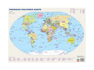
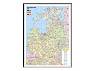
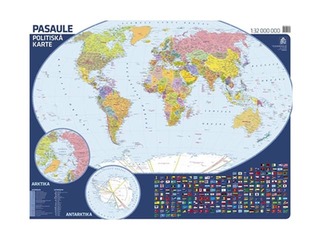
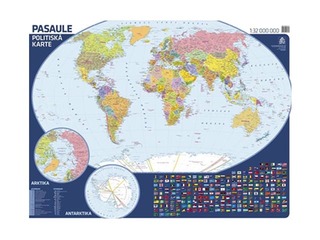
• World Map: Wall maps often depict the political or physical map of the world, showing all countries, oceans, and major cities. A world wall map is ideal for education or travel planning, especially in offices or classrooms, as well as for room decoration.
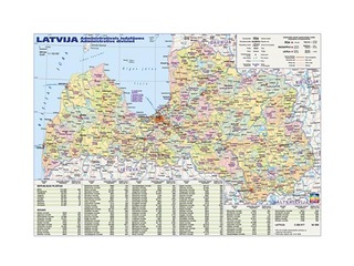
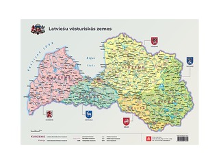
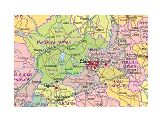
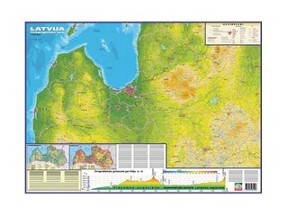
• Latvia Map: Shows the cities, regions, water bodies, and road networks of Latvia. A Latvia wall map can be detailed, providing geographical or administrative information.
• Layout and Size: Wall maps are usually larger in size and can be used both in educational institutions and offices to better visualize distances, routes, or geographical facts.
World and Latvia Table Maps:
• World Table Map: Smaller maps that are often placed on tables or stands. They are functional and easy to use in everyday work or studies.
• Latvia Table Map: Similar to world table maps, but depicting the specific territory of Latvia. These maps are useful for planning or creating travel routes and are easily placed on a table for clear visibility.
• Portable and Convenient: Table maps are easy to carry and convenient for use in offices, schools, or at home.
Significance:
• Education: Wall and table maps help children and adults learn the basics of geography, the location of countries and continents, as well as their cultural and natural features.
• Decor and Planning: Maps are often used as decorative elements in homes or offices, giving spaces an educational and sophisticated atmosphere. They also help people plan trips and understand geopolitical processes, and are often useful in work processes.
Here you will find answers to frequently asked questions about wall and table maps:
What sizes are wall maps typically available in?
Wall maps are usually available in different sizes depending on where they will be used:
• A1 (59.4 x 84.1 cm) — the most common size in schools and offices, as it provides clear and easily understandable information.
• A2 (42 x 59.4 cm) — a popular size for smaller rooms or homes.
• A0 (84.1 x 118.9 cm) — used in larger offices or public spaces where a large and detailed map is needed.
In Rolling, you will find many maps in various sizes for both larger and smaller rooms.
What types of Latvia maps can you find at Rolling?
• Administrative Map of Latvia depicts the administrative territories of Latvia, such as districts, cities, and parishes. This map helps to understand the structure of government administration and is used for administrative and legal purposes.
• Physiogeographical Map of Latvia shows the natural areas of the country and their geographical features, such as relief, water bodies, forests, swamps, and other geographical elements. It is used for research on nature and the environment.
• Flora and Fauna Map of Latvia provides information on various animal and plant species found in Latvia. It includes the areas where specific species are distributed and their conservation status.
What types of world maps can you find at Rolling?
• Political World Map depicts the world, dividing countries and their administrative territories, showing capitals, borders, and other political elements. This map is useful for understanding the political distribution and relations between countries.
• Physiogeographical World Map focuses on the physical elements of Earth, such as mountains, rivers, deserts, forests, and climate zones. It provides information about the planet's natural structure and geographical relief.
What types of Europe maps can you find at Rolling?
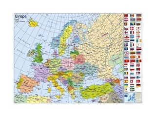
• Political Map of Europe depicts Europe with countries and their administrative territories, showing borders, capitals, and political regions. This map is useful for understanding Europe's political distribution and state relations.
• Physiogeographical Map of Europe provides information about Europe's natural and geographical features, such as mountains, rivers, valleys, and climate zones. It helps to understand the natural structure and relief of the continent.
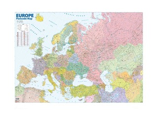
• European Postal Code Map depicts postal codes for each country and territory in Europe, showing precise zones that help with mail delivery and addressing. This map is used to determine and specify postal zones in various European countries.
What other interesting maps can you find at Rolling?
• Scratch-off Latvia Map is a map where you can scratch off the places you have visited. The surface of the map is covered with a scratch-off layer, and each visited location can be marked by scratching off the layer to reveal a specific area or object. This is a popular version of a travel memory map, allowing you to track the places you've visited in Latvia.
• Cork Board World Map is an interactive map made from cork material, allowing you to attach markers or map elements, such as pins or magnets. This map is popular for educational and interior design purposes, offering a visually interesting way to represent the geography of the world.
• Europe Map Puzzle is a puzzle depicting the map of Europe, allowing you to assemble countries and their borders. This puzzle is an excellent educational tool for learning European geography and the names of continents and countries.
• Latvia Map Puzzle is similar to the Europe map puzzle, but focuses on the map of Latvia. It helps children and adults better understand the administrative and physical structure of Latvia, showing the districts and cities of the country.
Wall and table maps are classic, timeless geographical tools that promote understanding of the world and its diversity. Find the perfect map of Latvia, Europe, or the world at the Rolling online store.
Shopping Cart
Close
Your basket currently is empty